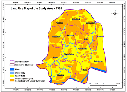
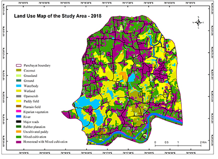
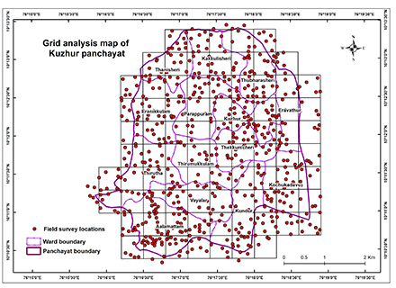
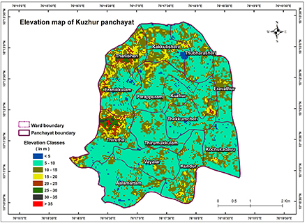
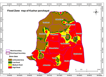
Floods are among the most powerful forces on earth. Floods arise when water surge the land that is already dry. Floods are the most common and one of the destructive natural hazards causing extensive damage to infrastructure, public and private services, the environment, the economy and devastation to human settlements. River floods are the most frequent and often devastating. It is mainly due to excessive rain, ruptured dam or levee, tides or cyclonic surges, rapid melting of snow, temporary backwater effects in sewers and local drainage channels, creation of unsanitary conditions, deposition of materials in stream channels during flood recession, rise of ground water coincident with increased stream flow and other geo-environmental influences. India is a developing country and floods have been regular phenomena in the country from the time immemorial. Almost every year floods of varying magnitude affect some parts of the country or other. Different regions of the country have different climates and rainfall patterns and so some parts face devastating floods and other parts may experience drought conditions at the same time. In recent years, many flood events were reported in the country which has caused damages to life and property. Kerala is a southwestern state of India with a total area of 38,863km2. The state is divided into 14 districts within 941 panchayat. Usually Kerala receives rainfall of about 3000mm annually. In 2018, the intensity of the south west monsoon was very high which resulted in severe flooding. This flood was recorded as the highest flood that the Kerala state has ever experienced. Earlier the “Great flood of 99” was reported as the highest flood in Kerala in theyear 1924 where the rain continued for about 3 weeks and many districts of the present Kerala were submerged in the water. The 2018 flood inundated 13 out of 14 districts in the state.The study was conducted in the Kuzhur panchayat which is one of the best panchayat in Thrissur district. Kuzhurpanchayat is a panchayat that was completely submerged in the 2018 floods. It is located in Mala block of Mukunthapuram taluk and the panchayat is bordered by Mala, Annamada Panchayats in the north, Poyya and Puthanvelikara panchayats in the west, Chalakudy river in the south, Annamada and Parakadavu panchayats in the east. Kuzhur is 37.6 km far from its District Main City,Thrissur. This panchayat has a geographical area of 19.11 sq.km and lies between 10º10’24” and 10º13’23.98” N latitude and 76º15’53.7” and 76º18’45.33” E longitude. The panchayat has 14 wards namely Thanissery, Kakkulissery, Thumbarassery, Kuzhur, Thekkumcherry, Eravathur, Kochukadavu, Kundoor, Vayalar, Alamattom, Thirutha, Thirumukkulam, Parappuram and Iranikulam. It has a total population of 19956 in which 9737 are males and 10219 females. The panchayat has 5603 households. (Kerala state land use board, 2007).