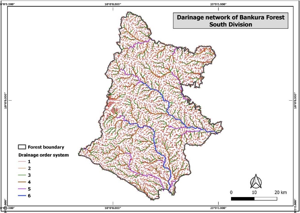
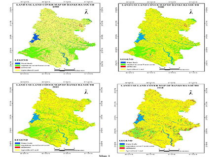
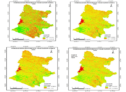
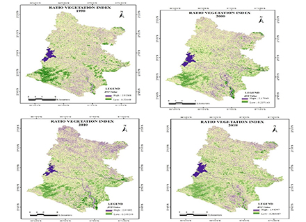
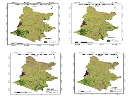
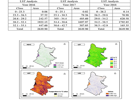
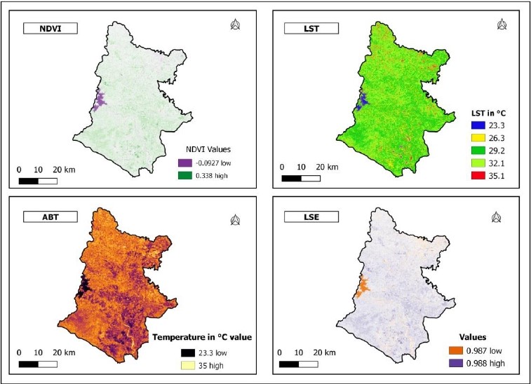
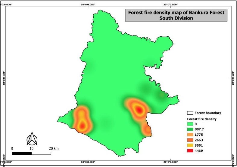
A majority of the rural poor in India is largely dependent on common property resources such as forest resources. Forests contribute extensively to the social and economic well-being of the rural poor. One -fifth of the land area of India is covered by forest. As per World Bank Report (2006), an estimated 275 million people in rural areas of India depend largely on forests. At the same time about half of India’s (around 89 million) tribal people, the most disadvantaged section of the Indian society, live in forest fringe areas, and they tend to have close cultural and economic links with the forest. In West Bengal, the total forest area is 11879 sq KM which is 13.38 percent of the total geographical area (FSI, 2011). Bankura is one of the westernmost districts of West Bengal and is known for its tribal culture and forest resources, basically, the southern part of Bankura district falls the Jangal Mahal (terminology used to represent forest area) division of the state. Bankura recorded a 1056 sq KM forest area which is about 15.34 percent of its total geographical area (FSI, 2011). As per the wasteland Atlas of India report (2011), about 203.64 sq KM of total forest area is degraded of the district, and maximum degradatiotakeske place in the southern part of the district. Over the past decades, tremendous progress has been made in demonstrating the potentials and limitations of the applications of remote sensing as well as geospatial technology in forest management. Geospatial technology can detect, identify, classify, evaluate and measure various forest characteristics in two ways: qualitatively and quantitatively. In a qualitative way, remote sensing can classify forest cover types. While the quantitative analysis can measure or estimate forest parameters (e.g., height, basal area, number of trees per unite area, timber volume, and woody biomass), floristic composition, life forms, and structure. For several types of applications of geospatial technology in forest management in specific regions of the world such as tropical areas, users of forest information are demanding the new establishment of sensors and platforms. Present-day, the available remote sensing information made it happens to monitor, maintain, and revitalize forest resources in a more scientific and sustainable way. In recent times demolition of forest cover and converting of forest land to others is an acute problem and lack of proper monitoring these problems increase day by day. The application of geospatial technology can overshadow the problems of forest monitoring which ultimately results from the sustainable growth of forest resources.