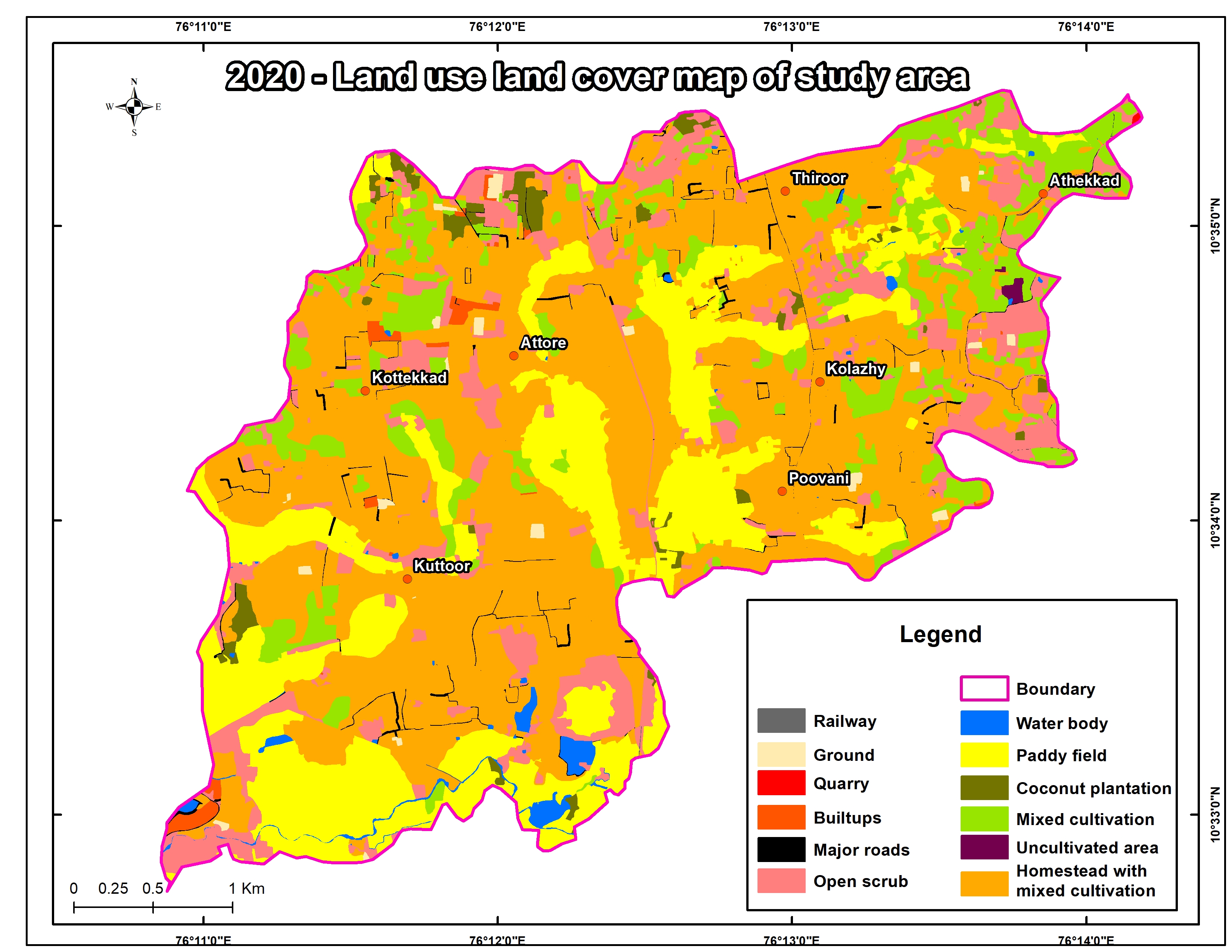
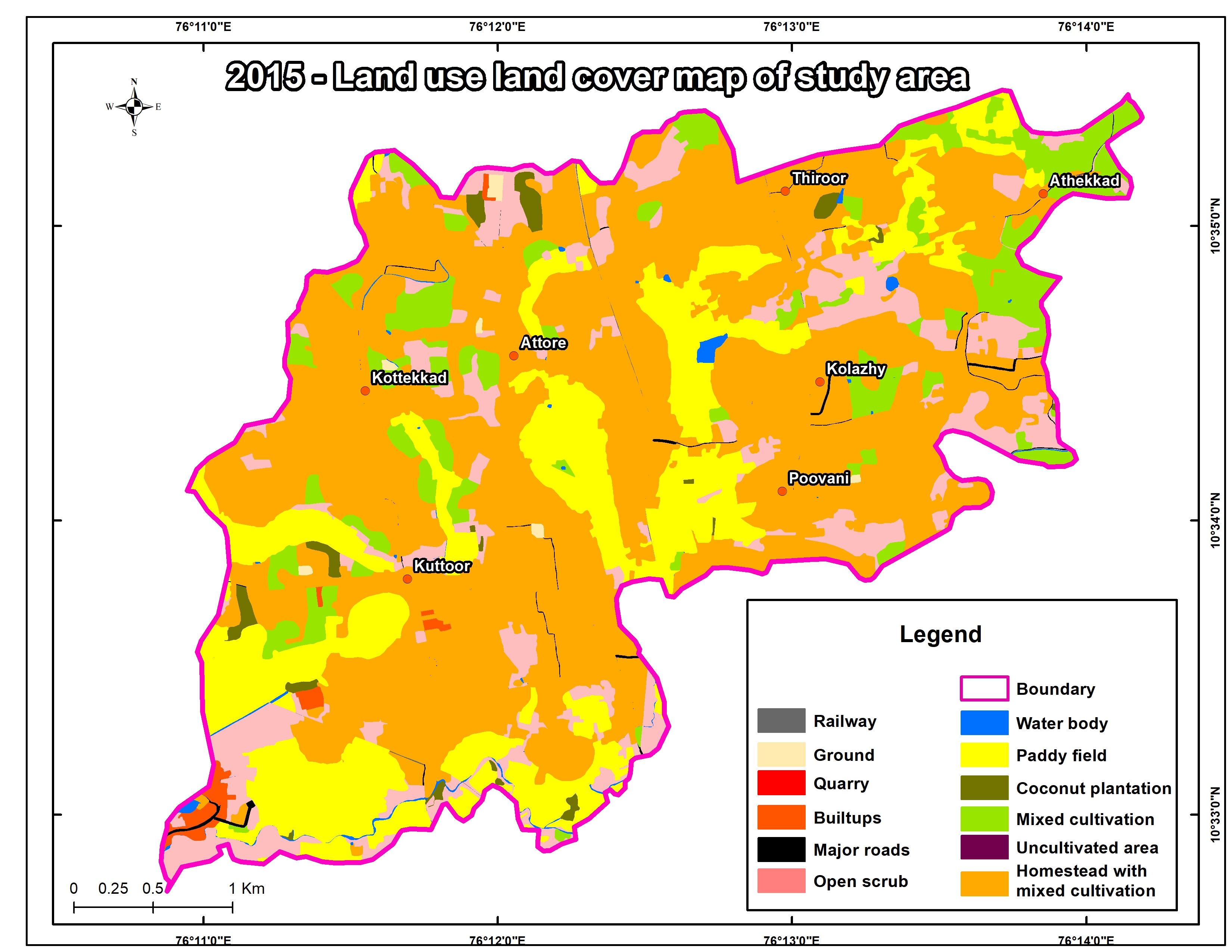
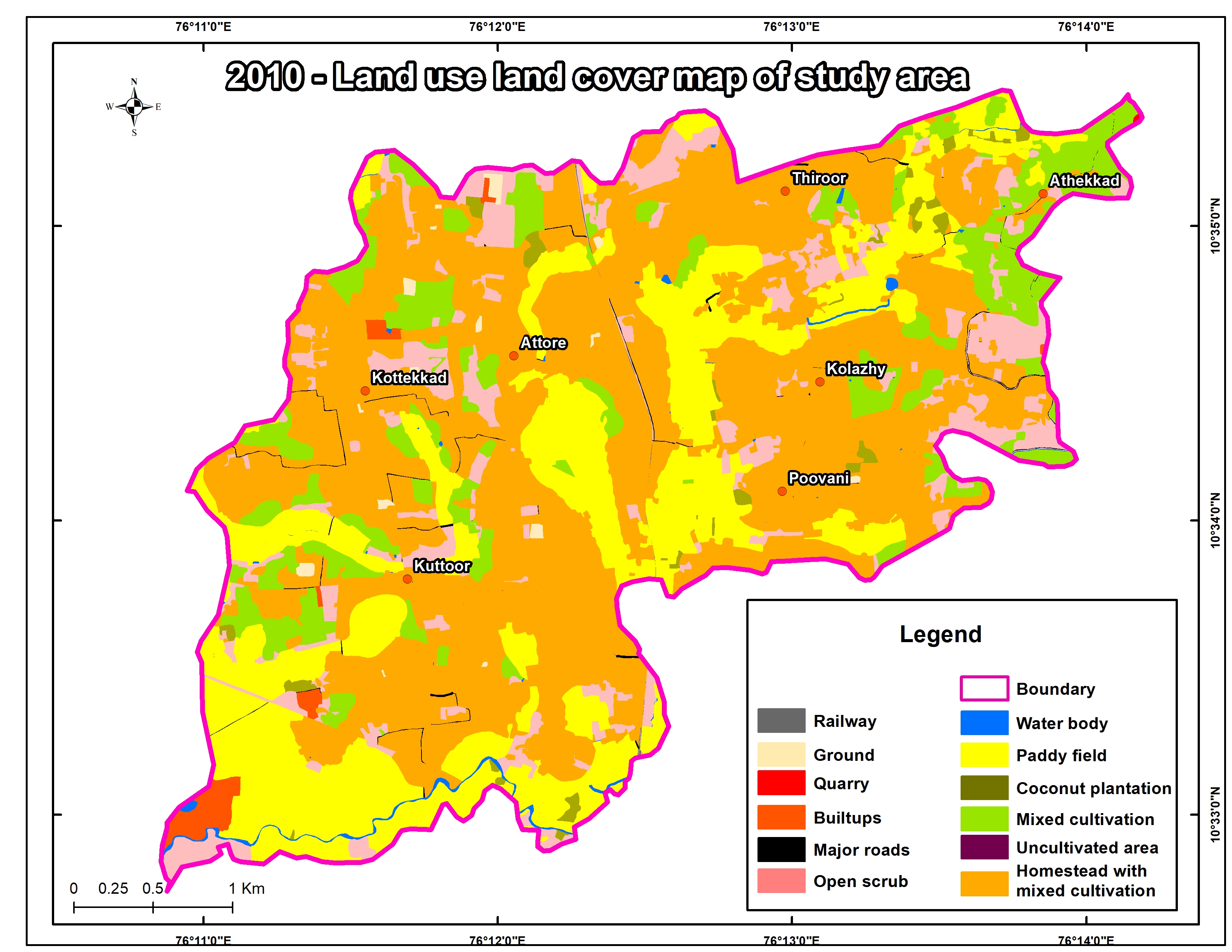
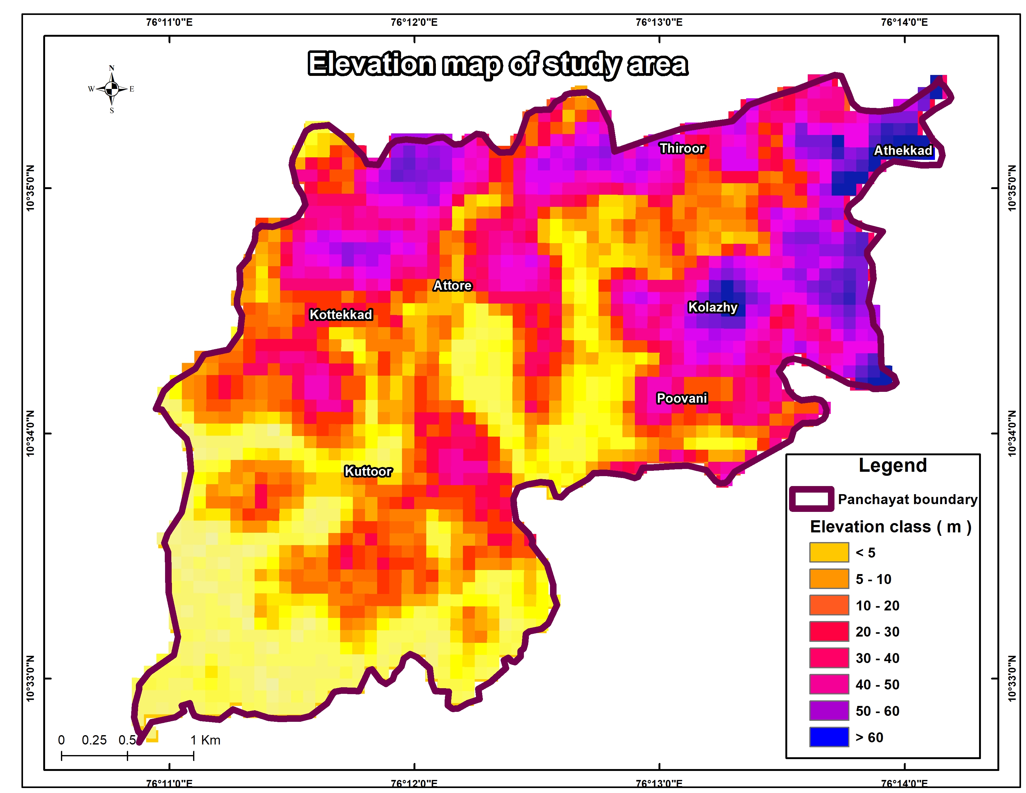
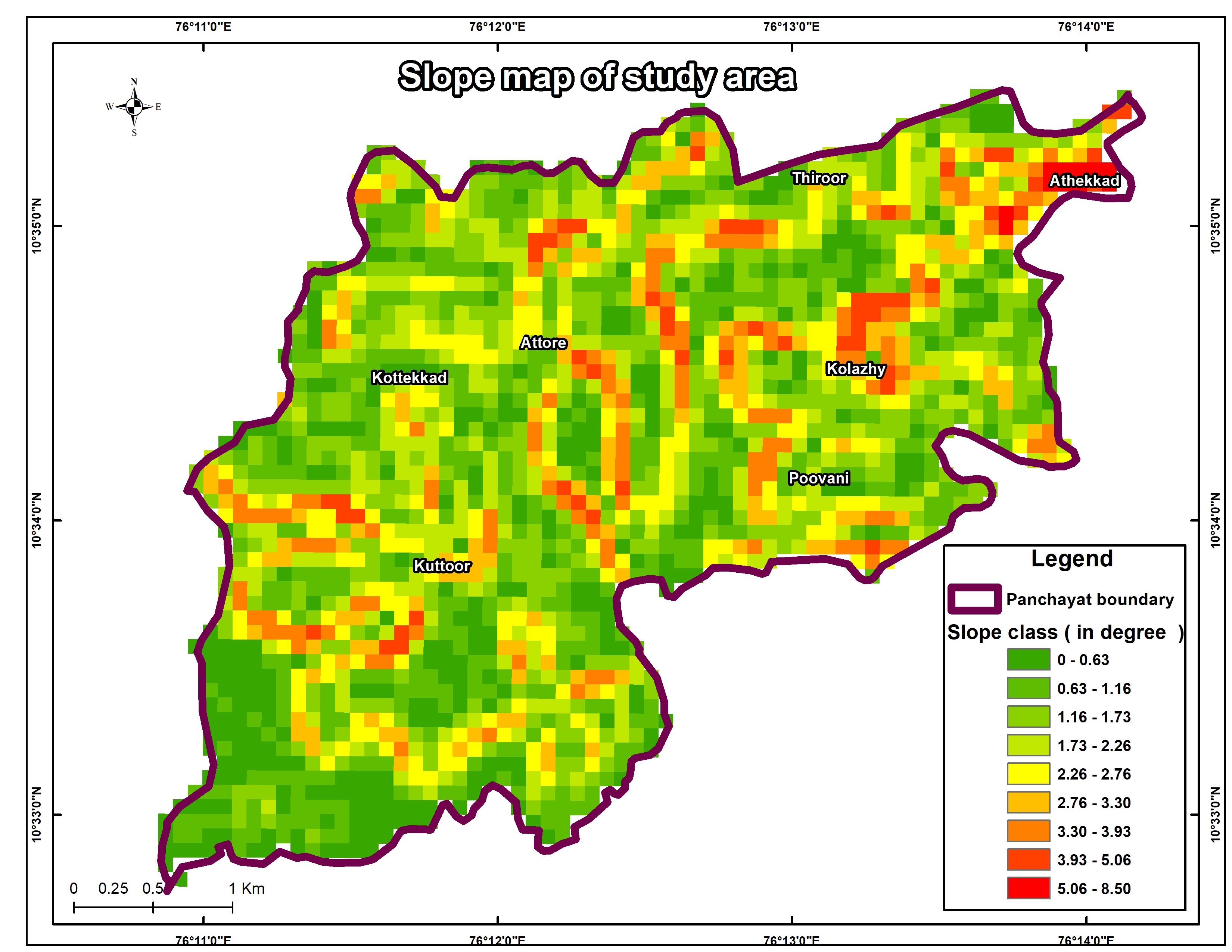
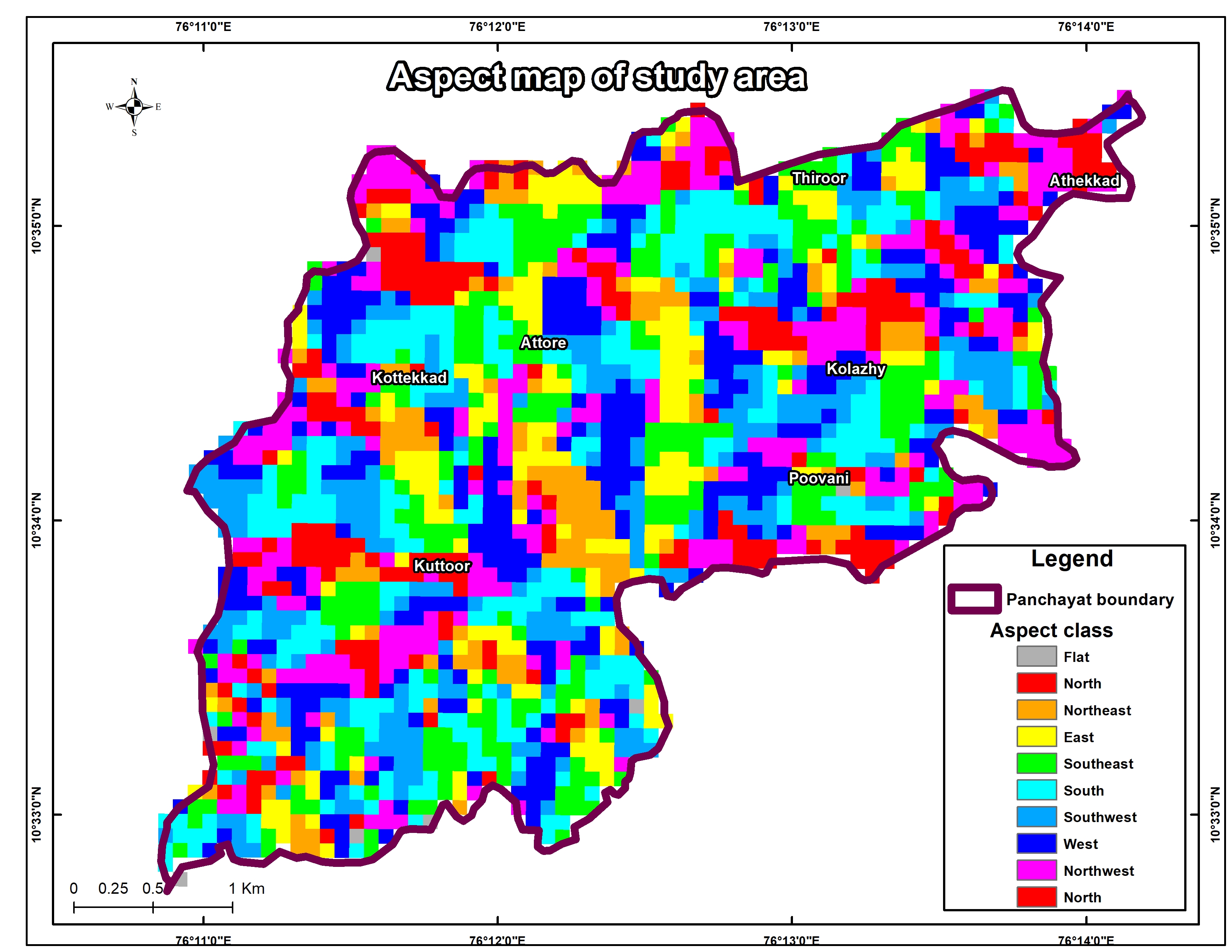
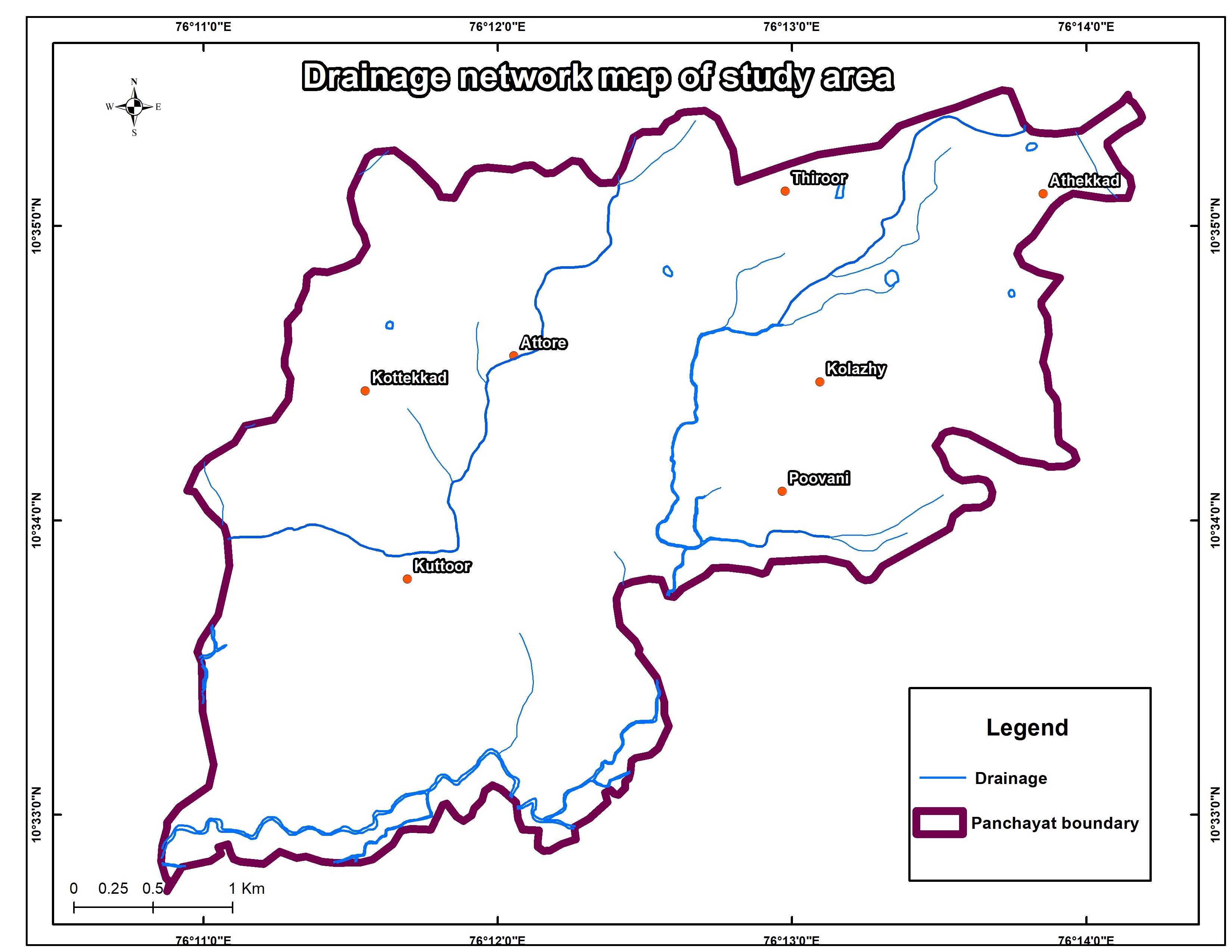
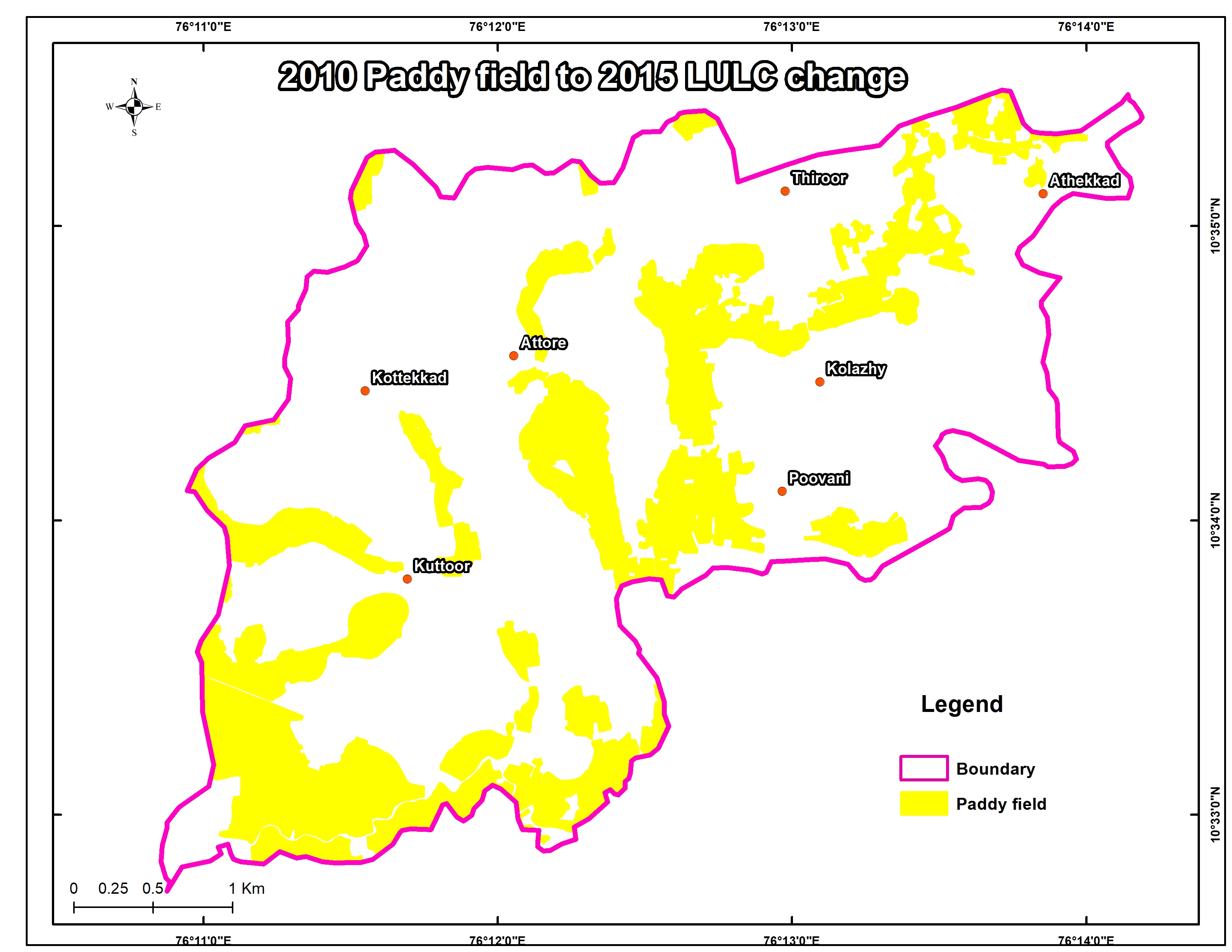
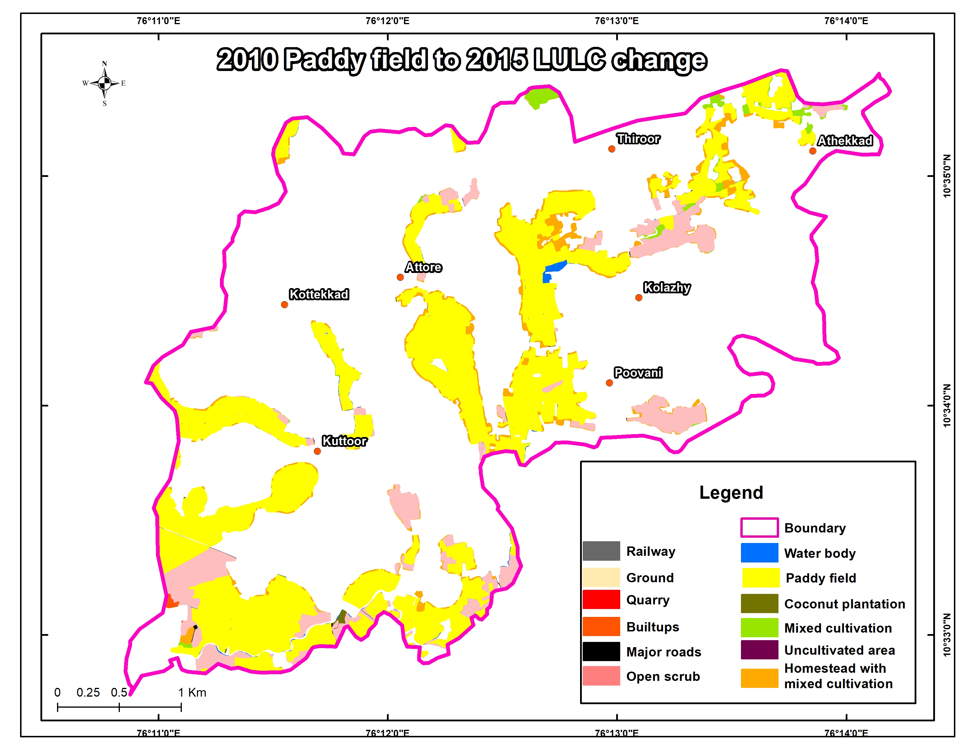
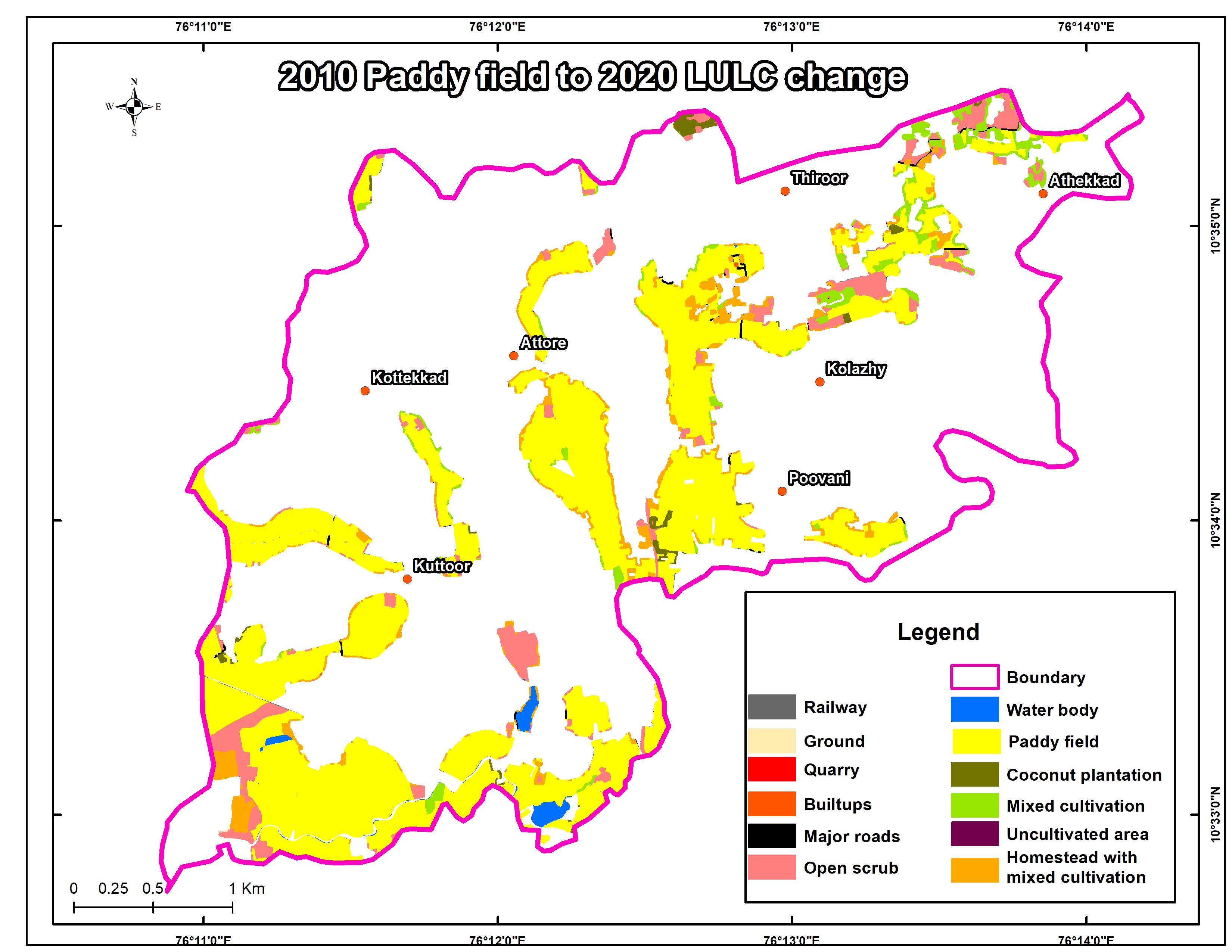
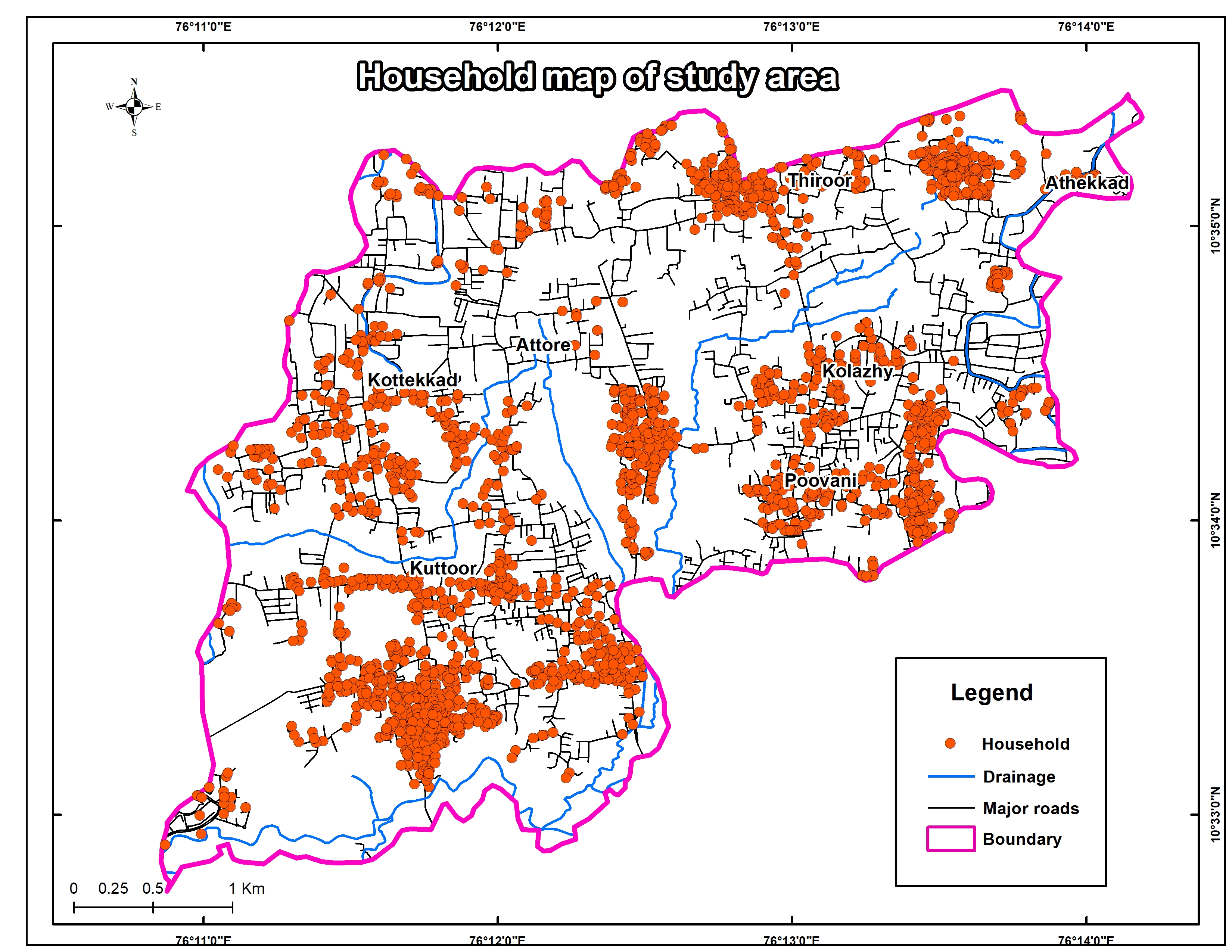
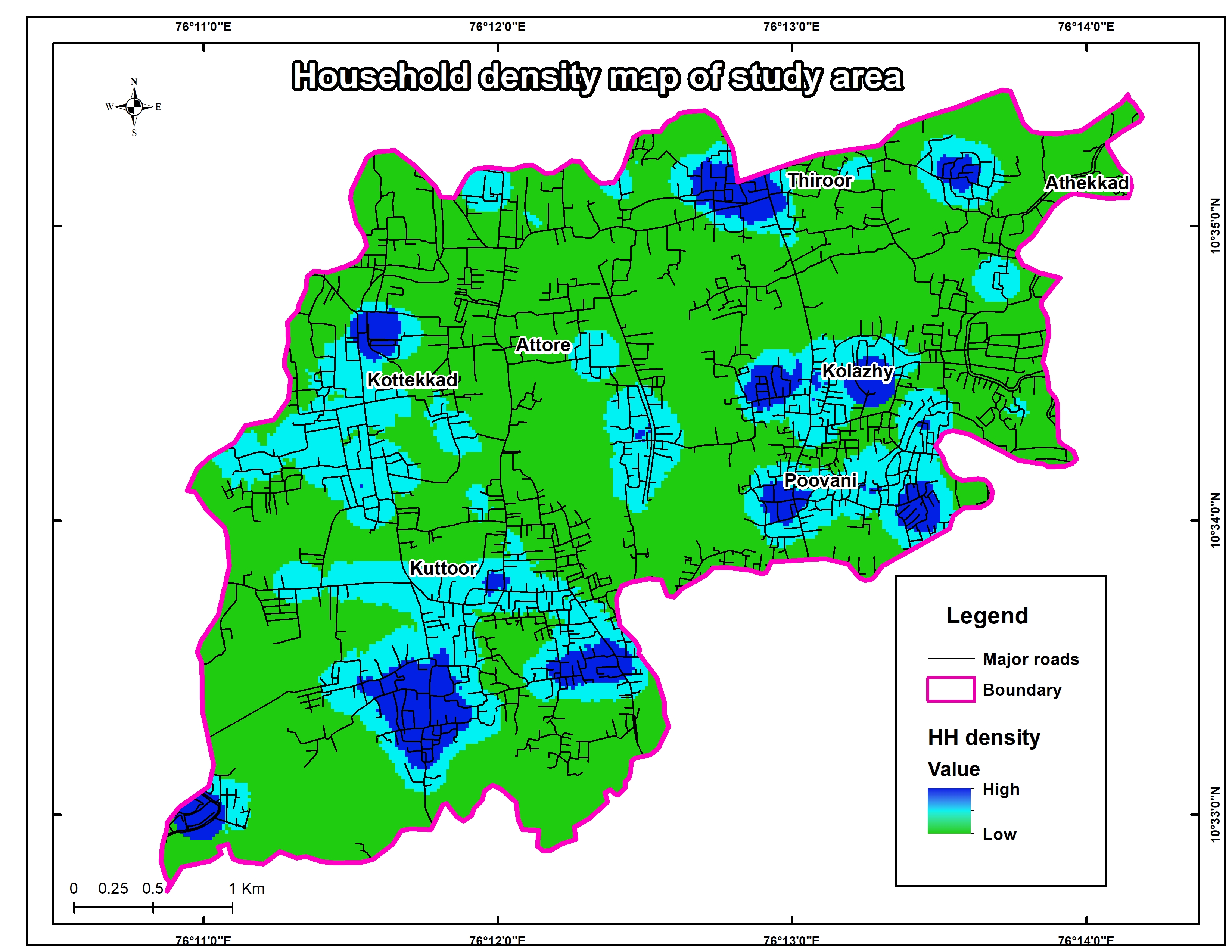
Land use land cover (LUCC) is an essential component in understanding the interactions of the human activities with the environment and thus it is necessary to be able to simulate changes. The study on the change of land use patterns in the world is of great significance to cope with global climate change. In this paper, an attempt is made to study the changes in land use and land cover in KolazhyPanchayat, Thrissur District, over 10 years period (2010-2020) due to its rapid increase in urbanisation. The study has been done through remote sensing technology and Geographic Information Systems (GISs). The comparison of LULC in 2010 and 2020 derived from the toposheet and the satellite imagery interpretation indicates that there is a significant increase in built-up area and a notable reduction in the agricultural land. Geomorphometricanalysis also carried out to find out the role of suface features like elevation, slope and aspect in determining the intensity of land use land cover change.There is also an analysis of drainage network, to find out the stream orders of the drainage systems and also for knowing the directions of each drainage. The result of study can help in better understand the surrounding of the study area and thereby exploring the effects caused by the land use land cover change.